

A cold front continues to move through Sunday evening, bringing rain showers and a isolated thunderstorm. Rain moves out around 10 p.m. with mostly cloudy skies continuing through Monday morning.
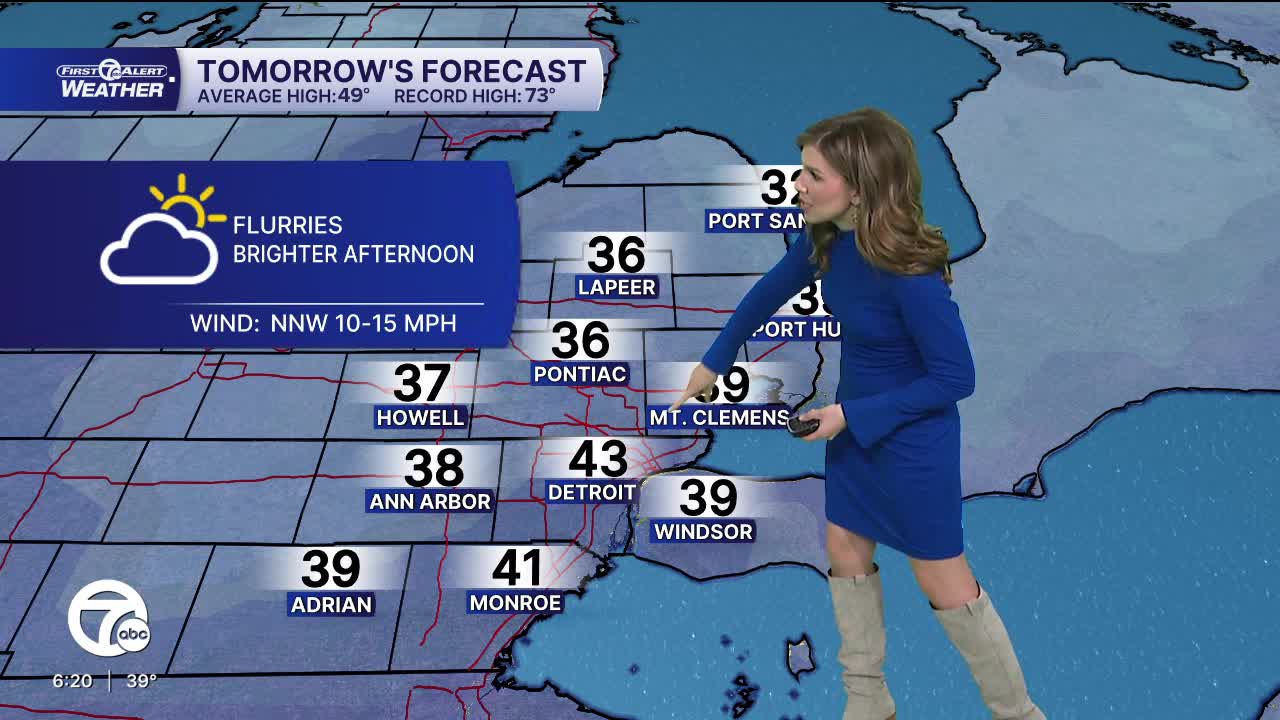
Temperatures start off just below freezing Monday morning, with a few flurries possible through midday. Clouds begin to break by the afternoon with highs in the upper 30s to low 40s.
Temperatures begin to climb Tuesday and Wednesday with highs back into the 50s. Clouds increase Tuesday, with mostly cloudy skies by Wednesday and a slight shower chance very late.
A storm system moves in Thursday bringing warm temperatures with highs in the low to mid 60s, followed by showers and a few storms along the cold front.
Check out the forecast below:
Sunday: Mostly cloudy. Lows in the upper 20s, near 30°. Winds: N 10 mph.
Monday: AM Flurries. Cloudy morning, brighter afternoon. Highs in the upper 30s to low 40s. Winds: NNW 10-15 mph.
Tuesday: Increasing clouds. Highs near 50°. Winds: SW 5-10 mph.
Connect with 7 First Alert Meteorologists on Facebook and X:
Facebook: Dave Rexroth , Hally Vogel, Marisa Woloszyn, Mike Taylor
X: Dave Rexroth , Hally Vogel, Marisa Woloszyn, Mike Taylor
Current Conditions
- Humidity: 94%
- Dew point: 69°
- Pressure: 29.81 in
- Wind speed: 5 mph
- Wind direction: SW
- Visibility: 9.0 mi
- Sunrise: 06:20 AM
- Sunset: 08:58 PM
