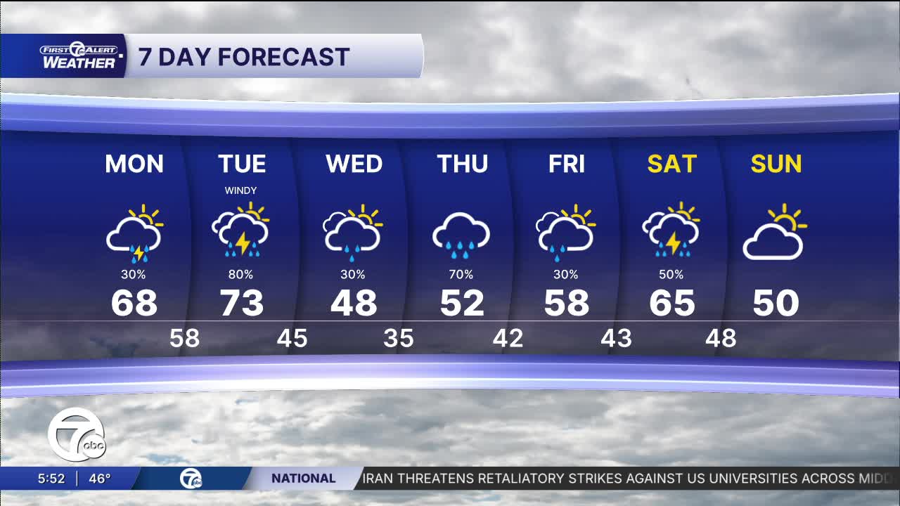


Warmer temperatures continue into the workweek, but the quiet weather does not. High temperatures climb into the upper 60s to low 70s, both Monday and Tuesday but with the warmth comes storm chances. After a partly to mostly cloudy day Monday, storms are possible in the late evening to overnight. A few of these storms may be strong to severe, with damaging hail being the biggest threat. Rain and storm chances continue into Tuesday, with more strong to severe storms possible Tuesday afternoon into the night. Damaging wind gusts are the biggest threat, but large hail and an isolated tornado are also possible.
Watch the latest forecast below


Temperatures drop Wednesday as cooler air filters in. Temperatures peak in the mid 40s in the afternoon. A few showers continue, but there is no threat for severe weather.
Steadier rain moves in Thursday, with a chance for a wintry mix north. High temperatures climb into the low 50s. Rain continues into Thursday night, before wrapping up Friday morning. Rain showers could impact tailgating for the Tigers' home opener, but should be wrapped up by the first pitch. Highs climb into the upper 50s by the afternoon.
Tonight: Partly cloudy. Lows in the low 40s. Winds: SW 5-10 mph.
Monday: Partly sunny. Storms late. Highs in the mid to upper 60s. Winds: SW 10-20 mph.
Monday Night: Storms likely. Lows in the upper 50s. Winds: SW 10-20 mph.
Tuesday: Rain and storms likely. Highs in the upper 60s to low 70s. Winds: SW 10-20 G30 mph.
Connect with 7 First Alert Meteorologists on Facebook and X:
Facebook: Dave Rexroth , Hally Vogel, Marisa Woloszyn, Mike Taylor
X: Dave Rexroth , Hally Vogel, Marisa Woloszyn, Mike Taylor
Current Conditions
- Humidity: 87%
- Dew point: 72°
- Pressure: 29.95 in
- Wind speed: 3 mph
- Wind direction: S
- Visibility: 10.0 mi
- Sunrise: 05:59 AM
- Sunset: 09:14 PM
